
Original file (SVG file, nominally 254 × 254 pixels, file size: 456 KB)
Summary
| Description |
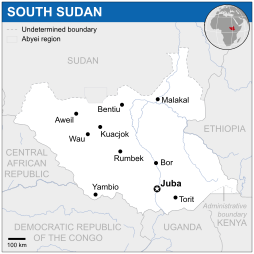
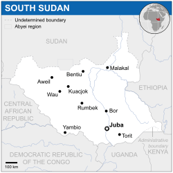
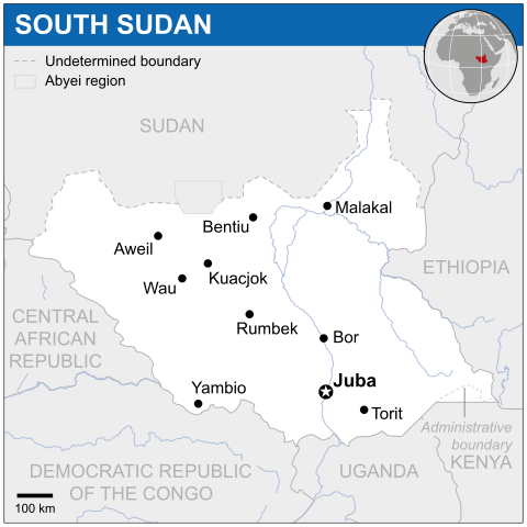
English: Locator map of South Sudan. |
| Date | |
| Source |
English: South Sudan Locator Map (ReliefWeb) |
| Author | |
| SVG development | This map was created with Adobe Illustrator. |

_-_SSD_-_UNOCHA.svg)
_-_SSD_-_UNOCHA.svg&action=edit&redlink=1)
_-_SSD_-_UNOCHA.svg)
_-_SSD_-_UNOCHA.svg&action=purge)
Licensing
- You are free:
- to share – to copy, distribute and transmit the work
- to remix – to adapt the work
- Under the following conditions:
- attribution – You must give appropriate credit, provide a link to the license, and indicate if changes were made. You may do so in any reasonable manner, but not in any way that suggests the licensor endorses you or your use.
 This map is part of a collection of 216 free country maps, created by the UN Office for the Coordination of Humanitarian Affairs (OCHA), to be used in print, web or broadcast products.
The ReliefWeb Location Maps released here are maps that highlight a country, its capital, major populated places and the surrounding regions. Attribution Requirements
Using the map without modifications: ensure that the sources and the disclaimer are below the map. Credit as follows: "Credit: OCHA". For use with alteration: remove the OCHA logo and disclaimer following any modification to the map, but keep the data sources as mentioned below the map. Credit the modified map as follows: "Based on OCHA map". You are responsible for the content of your map. We are keen to receive your feedback and hear how you used OCHA's maps. We would be grateful if you would notify us by e-mail and share your work with us. UN Disclaimer
The designations employed and the presentation of material of this map do not imply the expression of any opinion whatsoever on the part of the Secretariat of the United Nations concerning the legal status of any country, territory, city or area or of its authorities or concerning the delimitation of its frontiers or boundaries. |
File history
Click on a date/time to view the file as it appeared at that time.
| Date/Time | Thumbnail | Dimensions | User | Comment | |
|---|---|---|---|---|---|
| current | 22:38, 17 November 2014 | | 254 × 254 (456 KB) | wikimediacommons>Pharos | try without logo for now |
File usage
The following page uses this file:
_-_SSD_-_UNOCHA.svg)
_-_SSD_-_UNOCHA.svg)
_-_SSD_-_UNOCHA.svg&action=info)
-5F-2D-5FSSD-5F-2D-5FUNOCHA.svg)